
WikiWatershed is a web toolkit designed to help citizens, conservation practitioners, municipal decision-makers, researchers, educators, and students advance knowledge and stewardship of fresh water. WikiWatershed an initiative of Stroud Water Research Center, a global leader in freshwater science.
Author: Anthony Aufdenkampe
17. Who Uses Model My Watershed?
Model My Watershed is used by governmental and non-governmental organizations, environmental consulting firms, universities and other academic institutions, and K-12 schools.

Model My Watershed Release 1.22
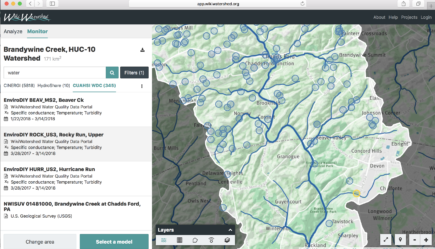
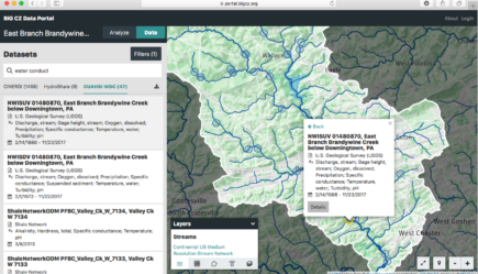
We unveil major new features such Monitor My Watershed for finding, visualizing and accessing monitoring data from hundreds of sources, and powerful new sharing and export capabilities for Model My Watershed.

Model My Watershed Release 1.21
We continue to pave the road for advanced features, with Release 1.21 focused on building a foundation for interoperability with other data and modeling platforms, while also including a pile of minor improvements and bug fixes.

Model My Watershed Release 1.20
Release 1.20 unveils nearly half a year of hard work overhauling the machinery "under the hood" to provide the high performance we need for the features that we'll roll out in the next year with funding from William Penn Foundation.

Model My Watershed Release 1.19
Release 1.19 delivers a user interface overhaul to improve workflow, add embedded help, and provide many new features.

Model My Watershed Release 1.18
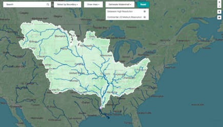
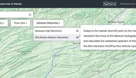
Release 1.18 introduces Rapid Watershed Delineation to any point in the continental USA, with automated delineation of watersheds up to 3 million square kilometers.

Model My Watershed Release 1.17
A major new feature: automated Rapid Watershed Delineation based on the National Hydrography Dataset!

Webinar: Model My Watershed for Resource Management
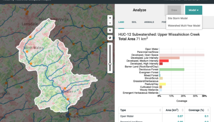
This webinar showed how to use the Model My Watershed web app to analyze real data, model stormwater runoff and water-quality impacts, and compare the impact of conservation or development scenarios.
