Release 1.17 of the Model My Watershed Web application was made public today.
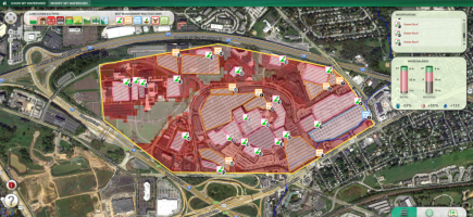
We are very excited by a major new feature: automated Rapid Watershed Delineation based on the National Elevation Model and the National Hydrography Dataset (NHDPlus v2). This feature has been implemented for any point in the Mid-Atlantic region (USGS water resource Region 2). For example, click on any point on the map near the lower Susquehanna River 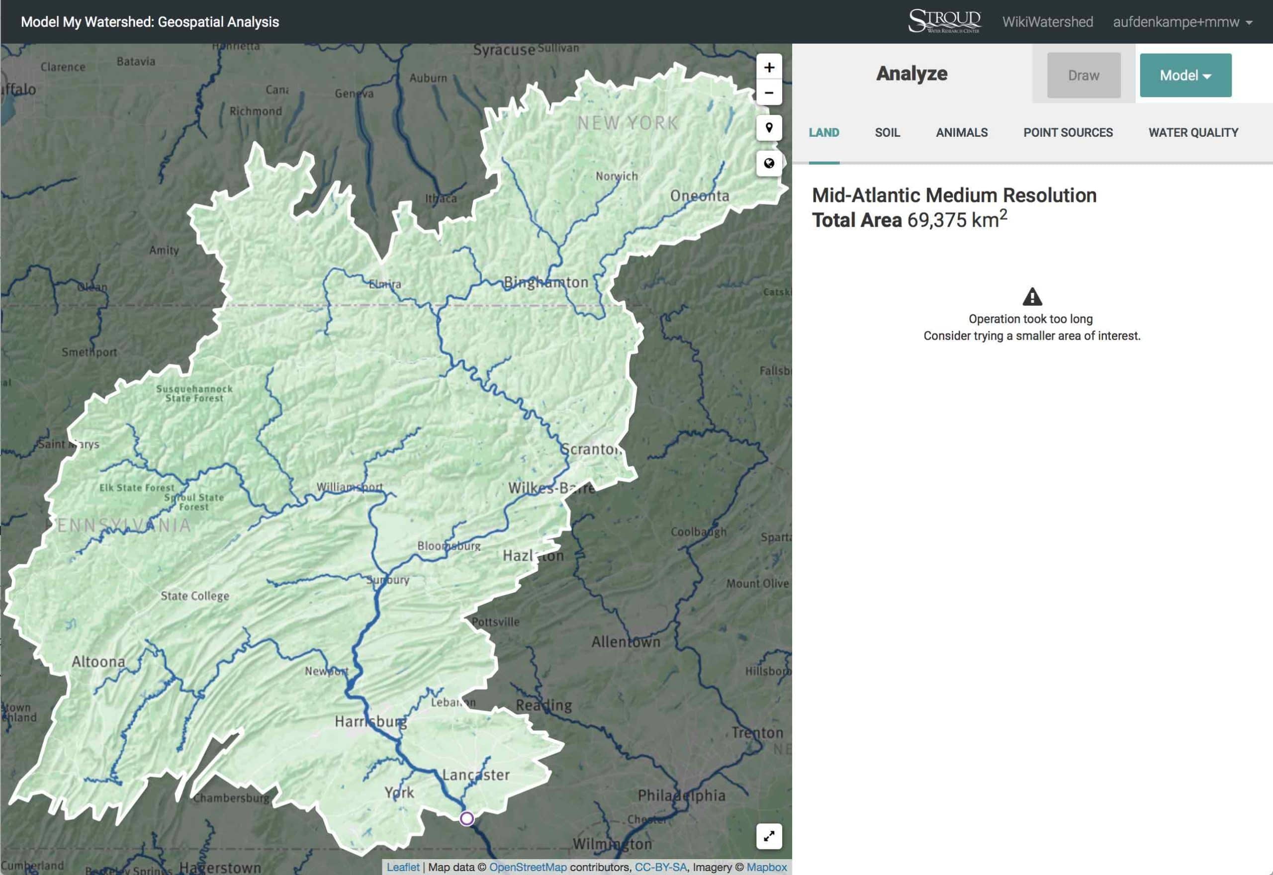 and your selection will “snap” downhill to the Susquehanna River channel and the calculate the entire upstream contributing area based on the 30 m resolution NHDPlus v2 flow direction grid. Unfortunately, our Analyze functions take too long for basins greater than about 20,000 km2 (about a quarter of the Susquehanna basin), but plan to upgrade performance of these functions sometime in the next few months.
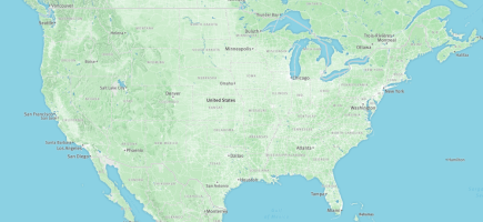
We will also soon will be rolling out the Rapid Watershed Delineation feature using NHDPlus for the entire “lower 48” states of the USA.
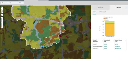
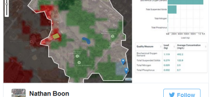
Our second new feature in this release was updated catchment water quality data based on Stream Reach Assessment Tool (SRAT) model estimates for the Delaware River Basin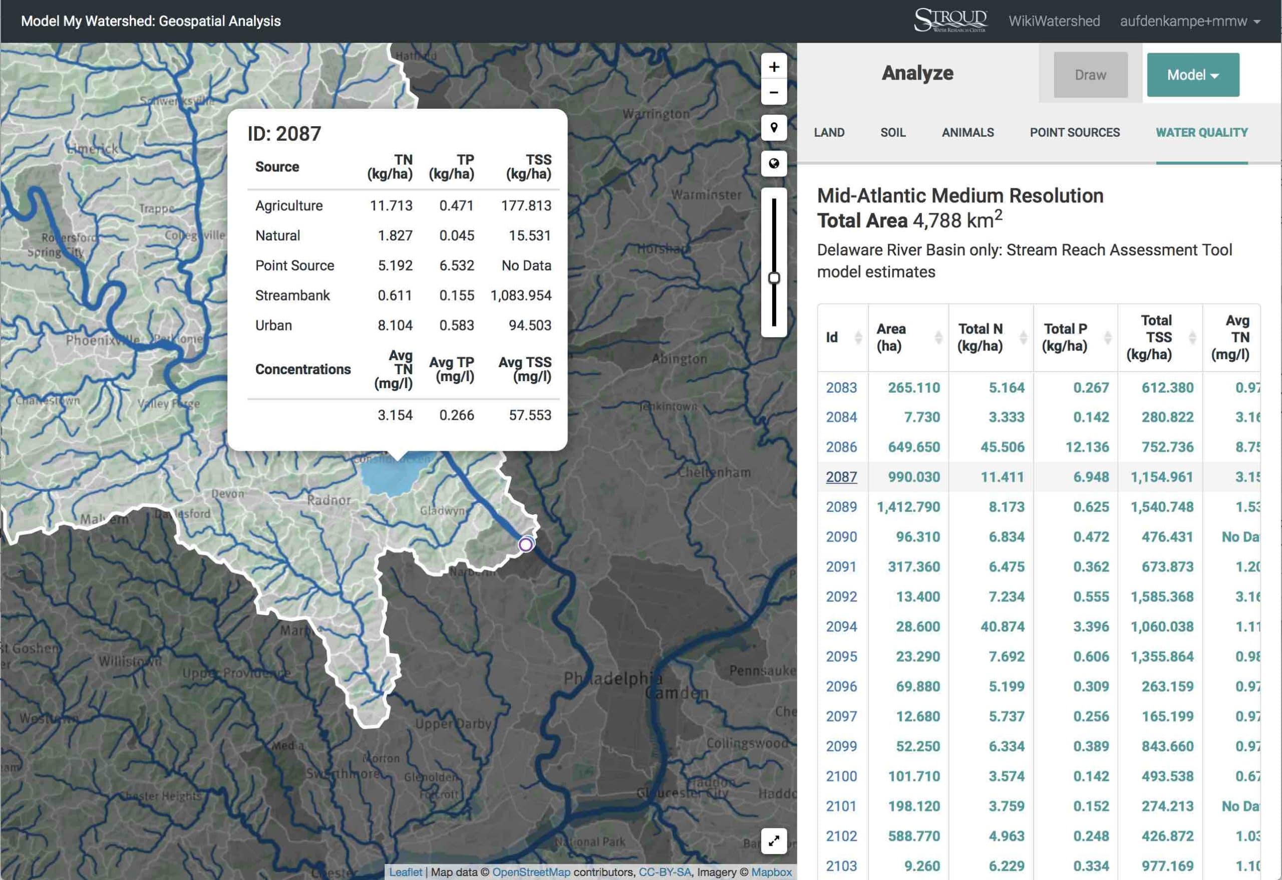 , which can be viewed in the Analyze sidebar once you have selected an Area of Interest (available in only for the Delaware River Basin).
These features complete our presently funded efforts to integrate features of the Stream Reach Assessment Tool into the Model My Watershed Web application for easy data exploration and visualization to support watershed conservation practices within the Delaware River Watershed Initiative funded by the William Penn Foundation.
We also implemented a number of bug fixes and other improvements.
For a full list of all improvements, see our Release Notes at https://github.com/WikiWatershed/model-my-watershed/releases.