Release 1.22 of the Model My Watershed web application was made public today!
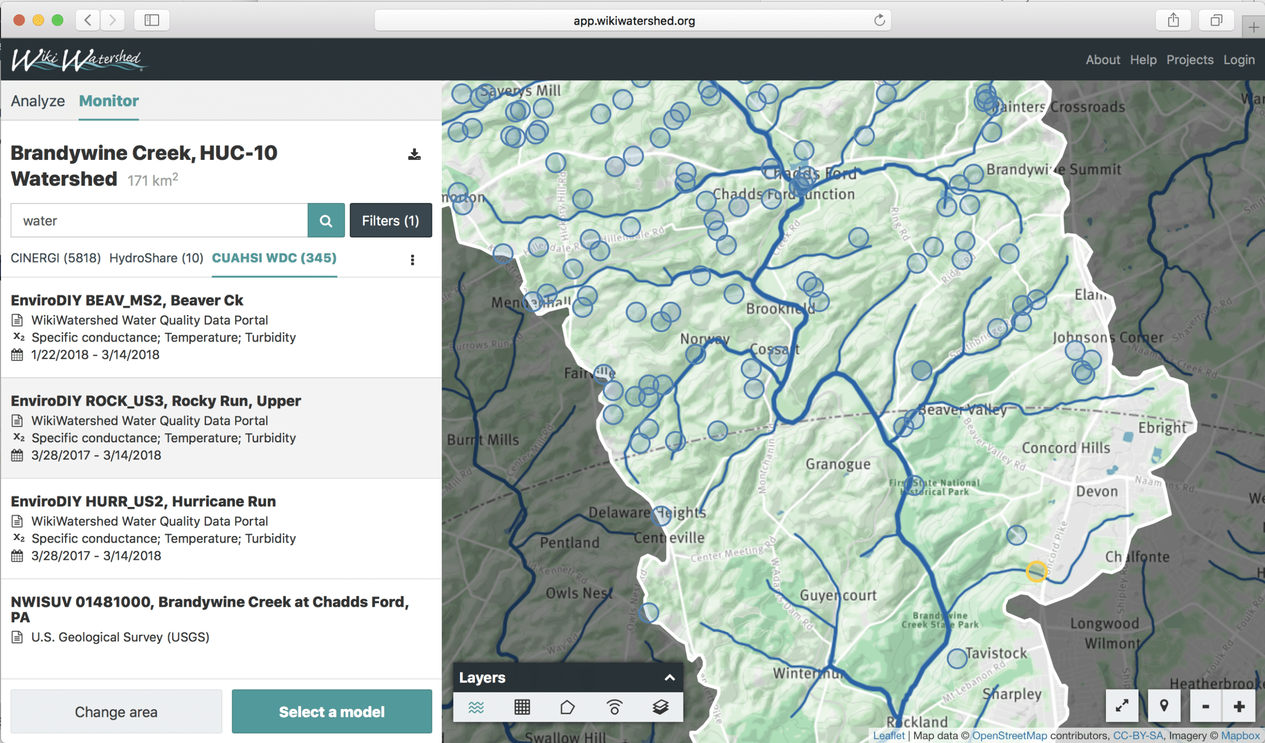
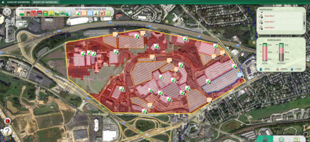
MMW Release 1.22 unveils Monitor My Watershed to search and visualize water data in the selected Area of Interest. CLICK TO EXPAND.
We are thrilled to unveil major new features, such as:
- Monitor My Watershed for finding, visualizing and accessing monitoring data from hundreds of sources;
- Powerful new sharing of Model My Watershed projects for others to find and copy for their use;
- Four new spatial Analysis tabs;
- Polygon download for your Area of Interest;
- and many other improvements and bug fixes.
Today we unveiled Monitor My Watershed within the WikiWatershed web app, finally integrating it with Model My Watershed as was originally envisioned in 2008. Once a user selects an area of interest, they now have the option to search for monitoring data from multiple federal, state, academic, and citizen sources, including from our EnviroDIY Water Quality Data Sharing Portal.

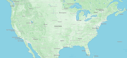
Monitoring site details include more information, such as tables and plots of recent data and links to the complete datasets. CLICK TO EXPAND.
After refining the search by zooming or by filtering with free-text terms or dates, the user can then click on a monitoring site to for detailed information, and in some cases tables and plots of the most recent data with links to complete datasets. Searches find data from three separate data catalogs (CINERGI, CUAHSI HydroShare, and CUAHSI Water Data Center). This work was prototyped for the BiG CZ Data Portal for NSF-funded earth surface scientists before going primetime to a broader community on WikiWatershed.
Stay tuned for our next Monitor My Watershed release, in which we will provide easy links and guides for how users can share their own data to the WikiWatershed and broader community via the EnviroDIY Water Quality Data Sharing Portal or via HydroShare.
Today we also unveiled a powerful new way to share Model My Watershed projects, so that others can find, view and copy any Model My Watershed model project that has been shared publicly. This new Share capability leverages CUAHSI HydroShare, an online collaborative environment for sharing hydrologic data and models. A Model My Watershed user doesn’t need to leave the WikiWatershed web app for this advanced sharing or for discovering other users’ modeling projects in their area of interest, due to the HydroShare search capability that we introduced with Monitor My Watershed, as described above. However, if user does follow a link to HydroShare, they will discover that they can copy the MMW project to reopen and edit it in their own Model My Watershed account, or that all MMW Analysis and Model results and shape files have been exported to HydroShare for easy 1-click download.
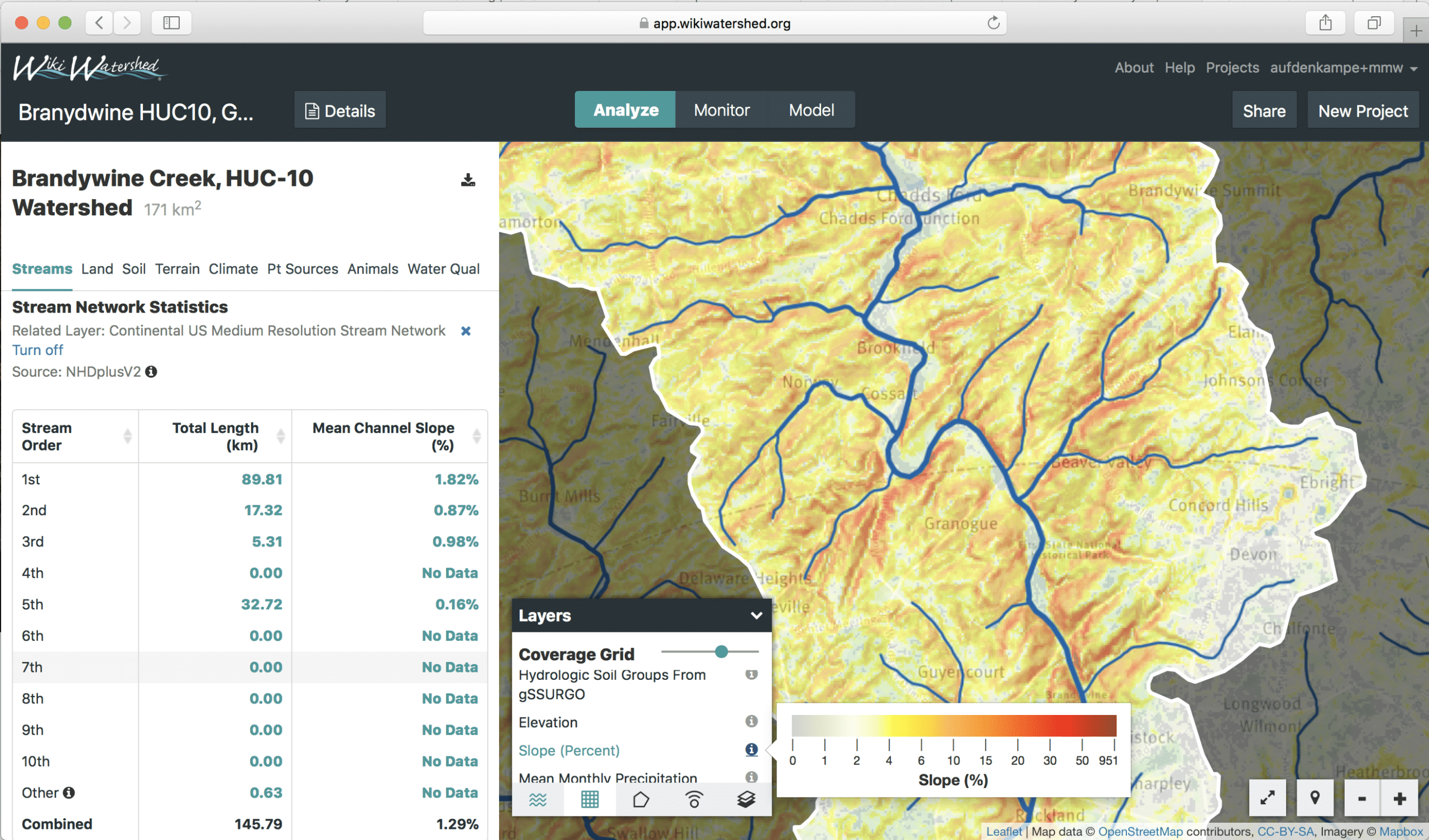
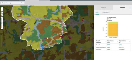
Streams, Terrain and Climate data are now visualized and analyzed. Have fun exploring! CLICK TO EXPAND.
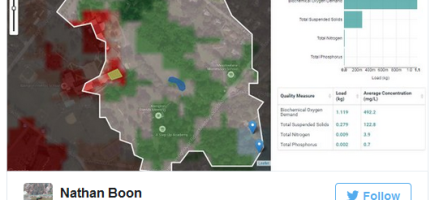
Today’s release 1.22 also unveils Analysis and visualization for five data layers. A new Streams Analysis tab lists stream lengths by stream order within an area of interest. A new Terrain Analysis tab provides statistics and links to visualize Elevation and Slope data from the USGS 30m National Elevation Model. These layers are particularly informative to a user exploring water flow paths and areas susceptible to erosion. A new Climate Analysis tab provides mean monthly and mean annual precipitation (MAP) and temperature (MAT) for any area of interest. We also provide visualization of each of these data layers, which are particularly useful when comparing differences in runoff and evapotranspiration between regions in the continental USA.
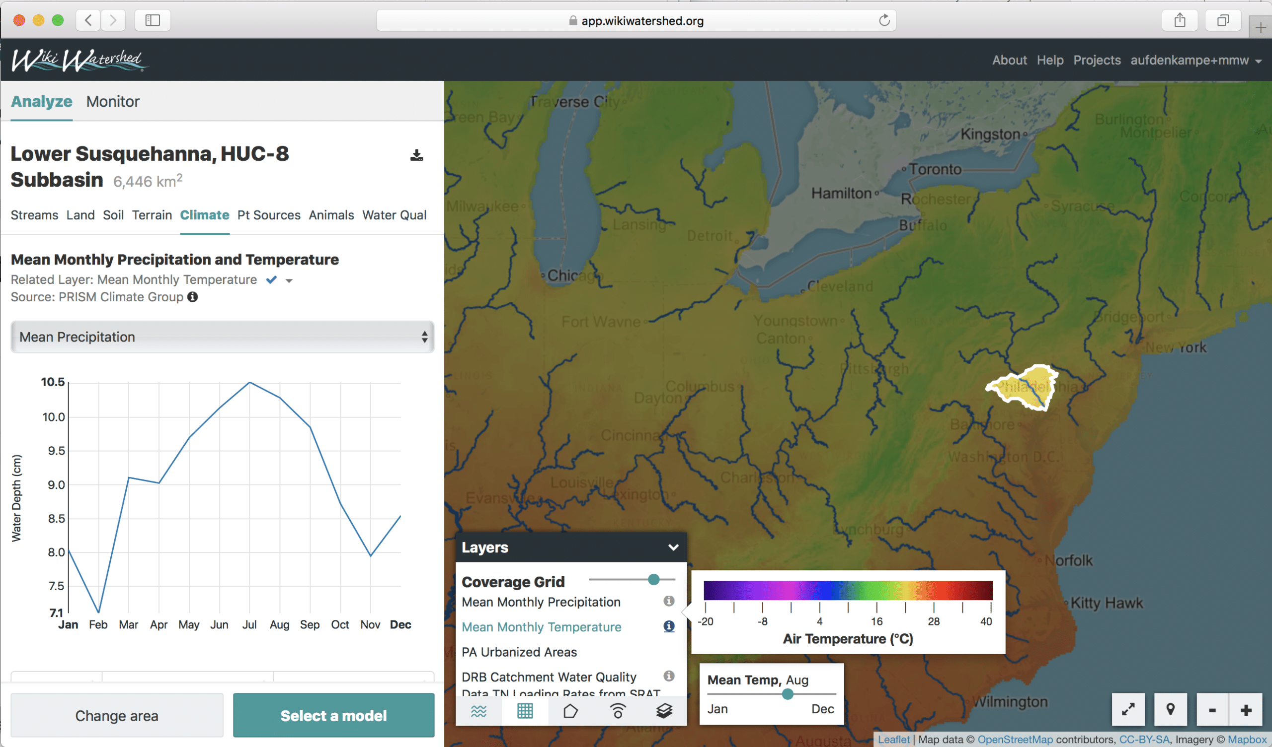
Mean monthly temperature and precipitation are particularly useful to visualize when comparing differences in runoff and evapotranspiration between regions. CLICK TO EXPAND.
Release 1.22 includes a number of other features, such as the ability to download the outline polygon for your Area of Interest, as either a shapefile or GeoJSON file, for use in any GIS application. The user profile pages have gotten another upgrade, with a new page for managing linked accounts such as HydroShare (via Open Authentication, or OAuth). As always, we made many other improvements and bug fixes with this release.
For a full list of all improvements and bug fixes, see our Release Notes at https://github.com/WikiWatershed/model-my-watershed/releases.