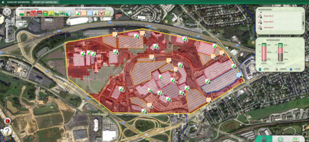
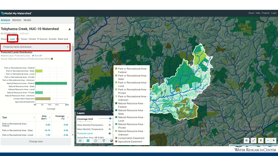
Release 1.27 of Model My Watershed enabled the automatic analysis of the Protected Lands layer (entire U.S.) when analyzing your area of interest. These data can now be found on the “Land” tab under analyze by selecting “Protected Lands” from the drop-down menu (see image below). The 2011 Land Use/Cover acreage/percentage is provided for each Protected Land category within the graphic and table under this drop down selection.
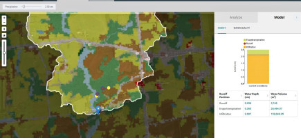
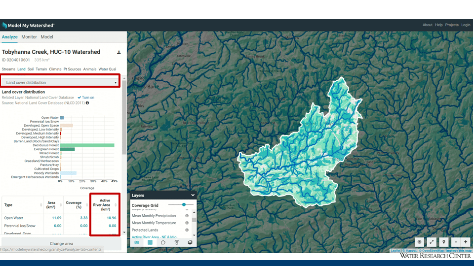
Likewise, the Active River Area (N.E. and Mid-Atlantic regions only) is included in the Land Cover distribution statistics after you analyze your area of interest (see image below).
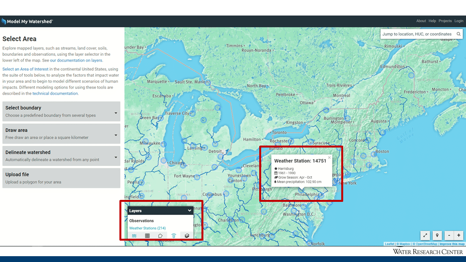
The third major improvement with this release was aimed at providing the user with information about the exact location and source for the meteorologic data (temperature and precipitation) used when using the Watershed Multi-Year model. The entire national grid of weather stations can be visualized by clicking on the “points icon” under the “Layers” palette and then clicking on “Weather Stations (214)”. Once activated, you can click on any weather station point on the map to find metadata about the specific weather station (see image below). Finally, if you run the Watershed Multi-Year Model, the map will automatically zoom out to an extent that captures the two weather stations that were used in the individual model run.
Technical details (can also be found on GitHub):
New Features:
- Protected Lands Analysis: Add summary statistics of Protected Lands in the selected area of interest to the Land Analysis tab.
#3226 #3228 #3261 - Weather Stations: Add weather stations layer under Observations tab, and highlight the weather stations used in a Watershed Multi-Year model run.
#3253 #3257 #3266 - Active River Area split across NLCD #3234
- Zoom to Area of Interest map button #3247
Bug Fixes:
- Update PA DEP Excel Spreadsheet
#3236 #3249 - Unit Conversion: Fix Missing Templates in MapShed Compare View #3240
- Fix ARA on Edge Cases #3241
Miscellaneous: