
WikiWatershed is a web toolkit designed to help citizens, conservation practitioners, municipal decision-makers, researchers, educators, and students advance knowledge and stewardship of fresh water. WikiWatershed an initiative of Stroud Water Research Center, a global leader in freshwater science.
Author: Dave Arscott

Model My Watershed Release 1.27
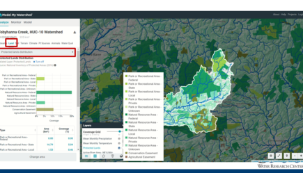
Release 1.27 of Model My Watershed enabled the automatic analysis of the Protected Lands layer (entire U.S.) when analyzing your area of interest. These data can now be found on the “Land” tab under analyze by selecting “Protected Lands”...[Read More]

Model My Watershed Release 1.26
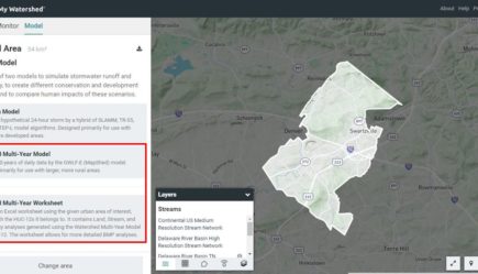
New features: Watershed Multi-Year Worksheet, Active River Area Analysis, and the ability to override C- and P-factors for cropland in the Watershed Multi-Year Model.

Model My Watershed Release 1.25
The August 2019 release updates back-end infrastructure software dependencies to present day versions/releases and addresses several bugs.

Model My Watershed Release 1.24
The December 2018 release of the Model My Watershed web app has several significant new data layers, features, and performance and graphical updates.
