WikiWatershed is a web toolkit designed to help citizens, conservation practitioners, municipal decision-makers, researchers, educators, and students advance knowledge and stewardship of fresh water. WikiWatershed an initiative of Stroud Water Research Center, a global leader in freshwater science.

3. Navigate the Map

Last updated on 2022-04-28

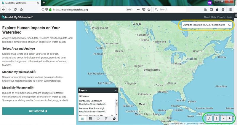
Once you have logged into the application, you will see a map looking much like Google Maps. If you shared your location, the application may zoom directly to your location, otherwise it will begin by showing a map of North America.

As with most online map tools, you can navigate the map by clicking and dragging and zoom by pinching, using a scroll wheel, or using the zoom buttons (circled in green in the screenshot below).

You can also search for a location by name or address using the search box (circled in yellow). To go or return to your current location, click the map pin icon to the left of the zoom buttons (circled in green). The double-arrow icon to the left of the map pin icon will expand the map to full screen.

Model My Watershed search bar
Search for a location by name or address using the search box. To go or return to your current location, click the map pin icon.

Was this article helpful?

Send Us Feedback

Scroll to the bottom of the article to tell us if it was helpful. A “Yes” will make our day, but if you answer “No” you can then send us a brief message to help us improve.

Can’t Find the Answer?

If you’ve searched the knowledge base and still need help, please reach out to our team.
Contact Us