WikiWatershed is a web toolkit designed to help citizens, conservation practitioners, municipal decision-makers, researchers, educators, and students advance knowledge and stewardship of fresh water. WikiWatershed an initiative of Stroud Water Research Center, a global leader in freshwater science.

3. MapShed Walkthrough

Last updated on 2022-09-28

Please note: Model My Watershed’s Watershed Multi-Year Model is now the primary framework for running the latest GWLF-E model version. It has replaced MapShed and BASINS because those desktop applications were built on the aging MapWindow GIS package that is no longer supported. If you have questions beyond what is provided in this documentation, please contact us so that we can connect you with MapShed developer Barry Evans, Ph.D.

Alternatively, you can run the latest version in Model My Watershed.

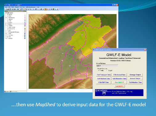
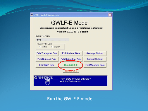
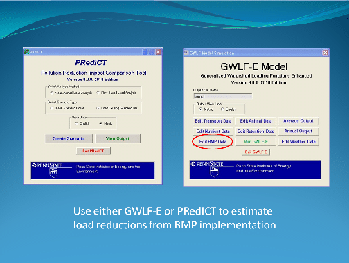
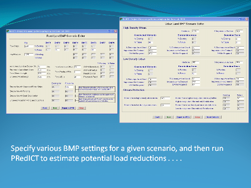
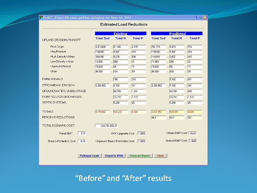
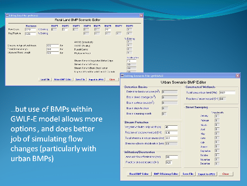
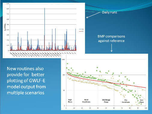
The following screenshots demonstrate how to use MapShed. You can also view MapShed video tutorials in a later section in this document.


Was this article helpful?

Send Us Feedback

Scroll to the bottom of the article to tell us if it was helpful. A “Yes” will make our day, but if you answer “No” you can then send us a brief message to help us improve.

Can’t Find the Answer?

If you’ve searched the knowledge base and still need help, please reach out to our team.
Contact Us