WikiWatershed is a web toolkit designed to help citizens, conservation practitioners, municipal decision-makers, researchers, educators, and students advance knowledge and stewardship of fresh water. WikiWatershed an initiative of Stroud Water Research Center, a global leader in freshwater science.

3. Selecting Land Cover Type

Last updated on 2022-04-28

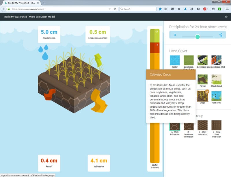
Below the rainfall, you can select the land cover type. These land cover types and the general color scheme are taken directly from the National Land Cover Database made by the U.S. Geological Survey. A help bubble describing each land cover type will appear as you hover over that land type.

Click on a land cover type to select it; hover over a land cover type to see a description.

Can’t Find the Answer?

If you’ve searched the knowledge base and still need help, please reach out to our team.
Contact Us