
Use the Upload file link under Select Area to upload and study a custom polygon. You can drag and drop or select shapefiles or GeoJSON files and then use that study area for all analysis and modeling in Model My Watershed.
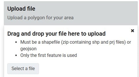
Uploading Shapefiles
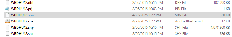
When uploading a shapefile, be sure to capture in the zip file all of the file extensions that comprise the shapefile you are trying to upload, not just the .shp and .prj files. You can open a File Explorer window to see all of the files associated with your shapefile. You may note that the files have different dates and file sizes.
Uploading GeoJSON Files
As an alternative, you can convert your shapefile to a GeoJSON file and upload that instead. The GeoJSON essentially acts as a zip file. You should be able to do this in the GIS software used to create the shapefile.
