
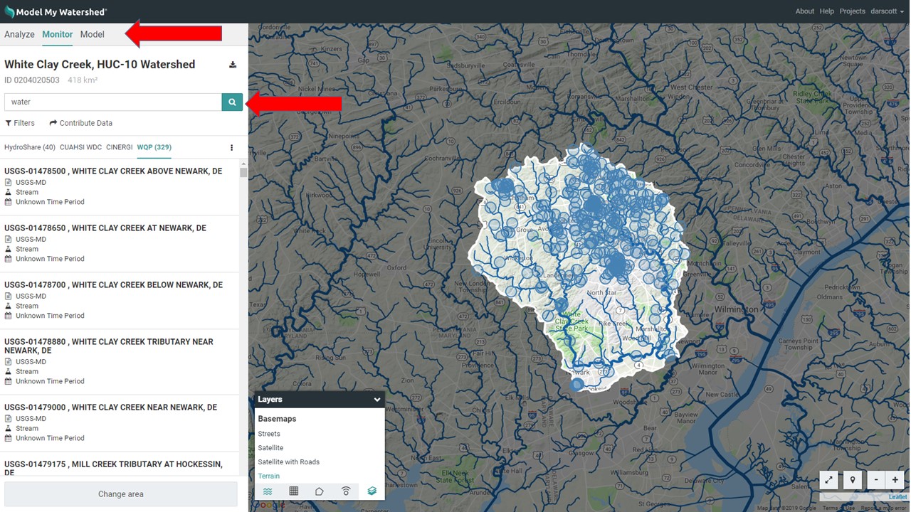
The “Monitor” feature within Model My Watershed allows any user to search multiple data catalogs/repositories for related datasets. After geospatial analysis of an Area of Interest, the user can search within that area for datasets contained in four separate data catalogs: HydroShare, CUAHSI WDC, CINERGI, and WQP (described below). The list of datasets can be filtered by free-text search and by time period coverage. A dataset can be selected for additional details, such as the dataset abstract and links to sources and web services. Once a user clicks on the word “Monitor”, a free-text search box is revealed on the left side panel (see image below). Typing a word or text string and clicking the “search” button will initiate the search.
6.1 HydroShare
HydroShare is an online collaborative environment for sharing hydrologic data and models. Its goal is to facilitate creation, collaboration around, discovery and access to data and model resources shared by members of the hydrology community.
6.2 CUAHSI WDC
The Consortium of Universities for the Advancement of Hydrologic Science, Inc. (CUAHSI) Water Data Center (WDC) provides tools for data access, analysis and collaboration, including a Catalog of hydrological time series data available as Water One Flow (WOF) and WaterML web services.
6.3 CINERGI
The Community Inventory of EarthCube Resources for Geosciences Interoperability (CINERGI) Data Portal is part of the Earthcube project. This data discovery and exploration tool for geosciences now features a geoportal interface with over 1,000,000 searchable records. Any user can contribute links to favorite resources so those repositories and datasets become searchable. The portal hosts a large inventory of high quality geoscience information resources, with standard metadata and traceable provenance.
6.4 WQP
The Water Quality Portal (WQP) is a cooperative service sponsored by the United States Geological Survey (USGS), the Environmental Protection Agency (EPA), and the National Water Quality Monitoring Council (NWQMC). It serves data collected by over 400 state, federal, tribal, and local agencies.
